FINDING YOUR BROWNSTONE – IN 1924
Brownstone Detectives investigates the history of our clients’ homes.
The story you are about to read was composed from research conducted in the course of one of those investigations.
Do you know the history of YOUR house?
********************************************************************************************************************************
Have you ever wondered what your neighborhood looked like in 1924?
Or 1951? Or 1996?
Aerial photography exists of all of New York City’s neighborhoods and is available to view (and zoom in on!) for free just by visiting NYC Map (a service of the City of New York).
Simply type your address in the box at the top of the page and click “Search.”
Then – in the upper right hand corner of the map – click on “Map Type,” and select the year you would like to view.
Here is a view of Stuyvesant East in Bedford-Stuyvesant (showing Saratoga Park) in 1924.
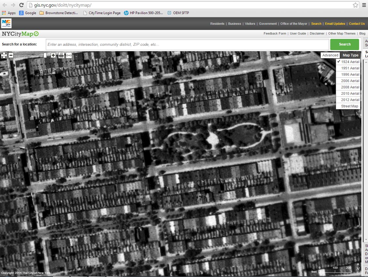
As you might have guessed, you won’t be able to see the expressions on peoples’ faces with this imagery, but it will give you a good indication of what your neighborhood looked like in any of these years.
For comparison’s sake, here is a view of the same section of Bedford-Stuyvesant (as above) – but for 1996. What differences do you note between the two pictures?

Comparing the two maps, you can see some obvious changes. Other than the fact that the second image is in color and was apparently taken in the winter time, if you look closely, you can see how whole swaths of brownstones have been torn down and replaced with such structures as schools and other planned housing projects.
These images can also help you to determine whether certain structures existed at certain times and when they might have been built or demolished.
Best of all, these maps are good plain fun.
O, and did we say they were free?
🙂
———————————————————————————————————————–
 Brownstone Detectives is an historic property research agency. Our mission is to document and save the histories of our clients’ homes. From our research, we produce our celebrated House History Books and House History Reports. Contact us today to begin discovering the history of your home.