FINDING YOUR BROWNSTONE – IN 1924
******************************************************************************************************************************** Brownstone Detectives investigates the history of our clients’ homes. The story you are about to read was composed from research conducted in the course of one of those investigations. Do you know the history of YOUR house? ******************************************************************************************************************************** Have you ever wondered what your neighborhood looked like in 1924? Or 1951? Or 1996? Aerial photography exists of all of New York City’s neighborhoods and is available to view (and zoom in on!) for free just by visiting NYC Map (a service of the City of New York). Simply type your address in the box at the top of the page and click “Search.” Then – in the upper right hand corner of the map – click on “Map Type,” and select the year you would like to view. Here is a view of Stuyvesant East in Bedford-Stuyvesant (showing Saratoga Park) in 1924. As you might have guessed, you won’t be able to see the expressions on peoples’ faces with this imagery, but it will give you a good indication of what your neighborhood looked like in any of these years. For comparison’s sake, here is a view of the same section of Bedford-Stuyvesant (as above) – but for 1996. What differences do you note between the two pictures? Comparing the two maps, you can see some obvious changes. Other than the fact that the second image is in color and was apparently taken in the winter time, if you look closely, you can see how whole swaths of brownstones […]
OL’ MAN LEFFERTS HAD A FARM, E-I-E-I-O (1874)
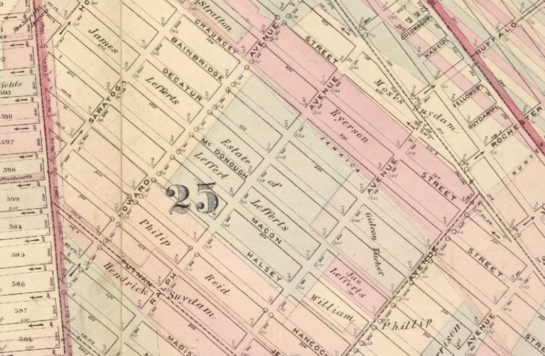
******************************************************************************************************************************** Brownstone Detectives investigates the history of our clients’ homes. The story you are about to read was composed from research conducted in the course of one of those investigations. Do you know the history of YOUR house? ******************************************************************************************************************************** Above is a section of the 1874 Beers Map of the City of Brooklyn focusing on the 25th Ward, drawn up before much was built in what would someday become the eastern section of Stuyvesant Heights. Development in this section, the 25th Ward, would intensify around the 1890s. As you can see from the map, there are a lot of names on it. They belong to the men who had previously owned the land as part of their farms. Around those names are drawn the former property lines of their farms. Thus, this map is called a “Farm Line” map. Now, if you can locate where you live on this map, you can see the name of the farmer who once owned the land your house sits on today. (If your house is not on this map, it is most certain on others. Let me know and I will help you find it – and your farmer’s name.) How many farmers you can see on this map? Follow @BrownstoneDetec Share ———————————————————————————————————————– The Brownstone Detectives Brownstone Detectives is an historic property research agency. Our mission is to document and save the histories of our clients’ homes. From our research, we produce our celebrated House History Books and House History Reports. Contact us […]