MR. DINKINS’ BULGING FACADE (1977)
Brownstone Detectives investigates the history of our clients’ homes.
The story you are about to read was composed from research conducted in the course of one of those investigations.
Do you know the history of YOUR house?
********************************************************************************************************************************
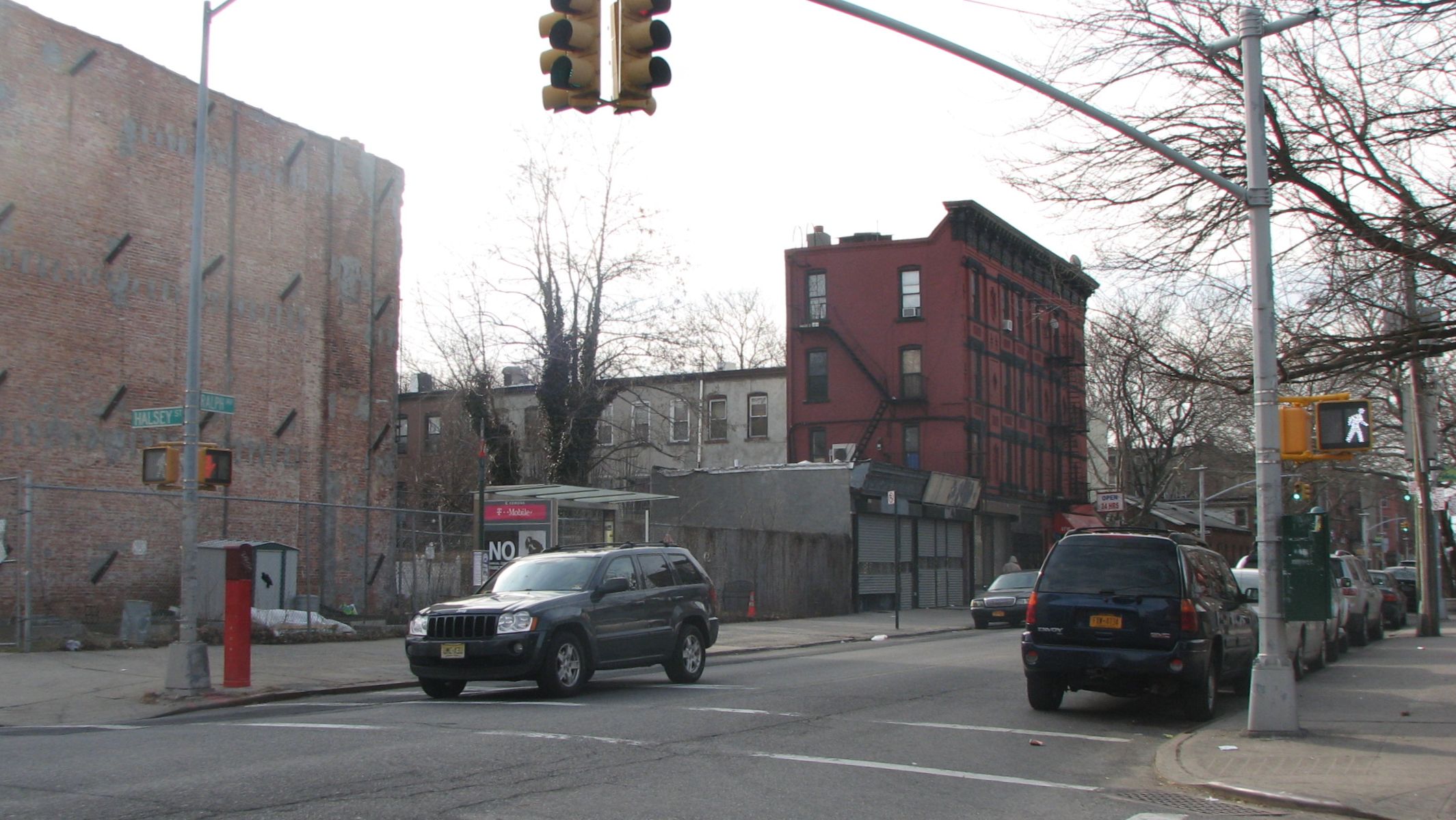
Have you ever wondered what once filled those large lots at the corners of Halsey Street and Ralph Avenue?
Every house has a history. You know it is there, but the clouds of the past work to obfuscate the present. Uncovering that history takes some detective work, but with a little time and some gumshoe sleuthing, the answers can be discovered.
With regard to 774 Halsey Street – what do we know happened? A fire? Decay? Gas explosion? What do we know about the life of the building? What was it used for? Who owned the building and who lived there?
We looked to clues from newspaper archives, fire insurance maps, and physical evidence to unravel that history. This is our report:
WHAT HAPPENED to 774?
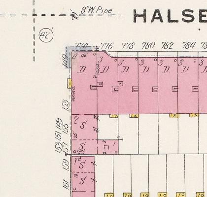
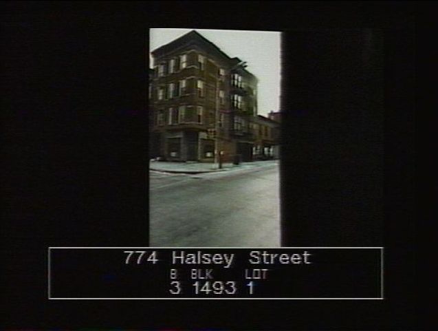
A 4-story brick apartment building – 774 Halsey Street – sat on the southeast corner of the Halsey/Ralph intersection. It had a commercial space on the ground floor facing Halsey Street and one at the rear of the building at 153 Ralph Avenue. The building housed a number of apartments the addresses/entrances of which were on the Ralph side of the building at 149 Ralph Avenue. The apartments of the Ralph-facing side of the building had stacked bay windows, one on each floor.
South of this building were two 2-story structures, 155 and 157 Ralph Avenue, the latter of which had a square bay window on the second floor overlooking Ralph Avenue. These were primarily commercial addresses with businesses on the ground floors and second stories.
Ralph was a busy commercial corridor from the 1890s with shops up and down its length on both sides, along with a streetcar line that ran its length. As the avenue was developed, speculators built primarily businesses and apartment buildings along it, figuring that most people would rather live along the streets rather than the busy, noisy, and dusty avenues.
WHAT DOES THE EVIDENCE SHOW?
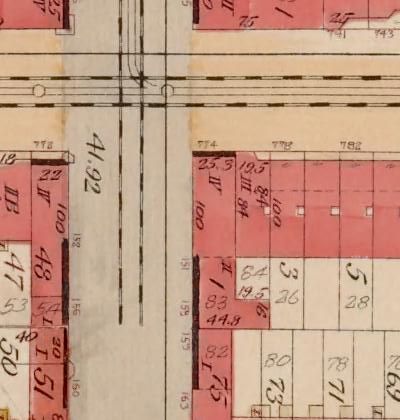
On the 1888 Sanborn Fire Insurance map for the City of Brooklyn, the entire block – bounded by Halsey, Ralph, Macon, and Howard – was vacant. Buildings had been sprouting up on the northern side of Halsey Street, but no construction had started yet on the south side.
By 1898-99, the Sanborn map of that year showed the entire block filled with houses, apartment buildings, and stores.
At 774 Halsey – on the southeast corner lot at Halsey Street and Ralph Avenue – existed a large 4-story brick apartment building. Directly south of that structure – 155 and 157 Ralph Avenue – were two 2-story brick buildings (the addresses to the second floor quarters were 149, 151 and 153).
This 1898-99 map showed that 774 Halsey Street had a “store in the first floor.” From a Brooklyn Daily Eagle story, we know that that commercial space held a saloon and that at 153 Ralph Avenue was Phillip King’s confectionery store.
Only a few years old at the time, these buildings had already started to gather some bad karma, as in 1895 and 1896 fires would break out that would affect the buildings and their residential and commercial tenants.
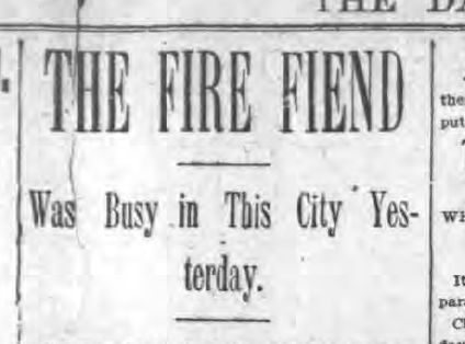
The first fire, in 1895, started in 774 Halsey. Frederick Groltman, who owned the building and ran the saloon on the ground floor, estimated damages to be $2,000. Several tenants on the three apartment floors above, also affected by the fire, estimated damages to furniture of about $500 apiece.
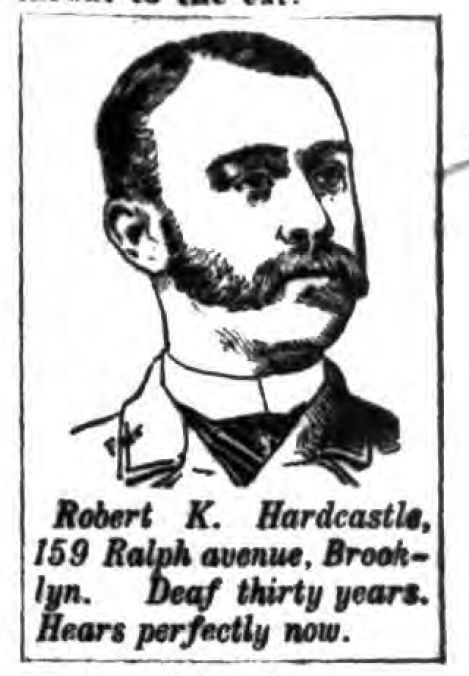
The following year, in early 1896, another fire broke out – this time in 153 Ralph Avenue, the rear part of the apartment building. This section housed Phillip King’s confectionery store on the ground level and the meeting rooms of the Twenty-fifth Ward Democratic Club on the second floor. The flames extended to 155 Ralph Avenue occupied by Hardcastle Brothers Undertakers. (Later, in the next century, Hardcastle Brothers would moved to 159 Ralph Avenue.)
After these two fires, 774 Halsey Street settled into a long period of calm, as it did not appear in any negative way in the press.
In 1912, rent for a month at 774 Halsey Street would set you back $12.
In 1914, the Department of Buildings issued an “unsafe building” citation. It is not known what the violation was for, exactly, or how it was settled.
In 1919, Ketchum Bros., a realty firm, was operating out of offices at 149 Ralph Avenue – probably just above the store.
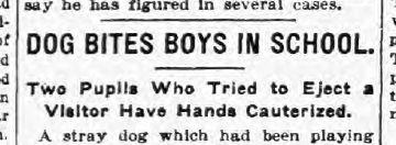 In 1925, a 16-year-old boy, Charles Potazzi, who lived at 774 Halsey, was bitten on the hand by a stray dog at his school, Public School 26, corner of Quincy Street and Ralph Avenue. Doctors cauterized the wound. Although it was not thought the dog mad, Public Health regulations required that they take the Pasteur treatment (yes, those long inoculation needles driven right into the stomach).
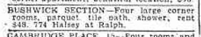
In 1930, the rent amount had risen to $48 a month. You got four large corner rooms, parquet floors, a tile bath, and a shower.
In 1931, the space above the store at 149 Ralph Avenue was being used by a tailor and was doubling as a polling station.
Little of note takes place with 774 Halsey Street or its neighboring buildings for the next 30 or so years, until the 1970s when public records show that the building has been taken over by the City.
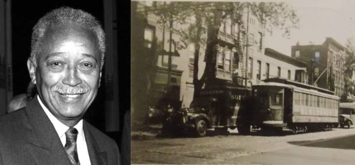
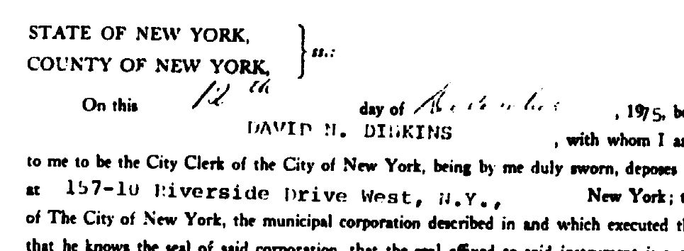
In 1976, City Clerk David N. Dinkins (New York City’s future mayor) sold the property at public auction for $6,800.
In 1982, the City would foreclose on the property; 774 Halsey Street would remain – from that point on – in the domain of the City.
In 1996, after a complaint was lodged with the City noting that the structure’s roof had collapsed, the Department of Buildings found that the “2ND STY WALL & 1ST STY BLOCK WALL BULGING OUT,” and an immediate emergency demolition was ordered.
Apparently, nothing was done, though, at the time, because ten years later in 2006 – a joint Department of Buildings and Housing Preservation Department inspection found that “FACADE BULGING OUTWARD. SIDE WALL CRACKED. REAR WALL CRACKED. BULKHEAD OUT OF PLUMB AND LEVEL.”
This time, though, the building’s days were numbered as a demolition order was issued late in 2006.
———————————————————————————————————————–
 Brownstone Detectives is an historic property research agency. Our mission is to document and save the histories of our clients’ homes. From our research, we produce our celebrated House History Books and House History Reports. Contact us today to begin discovering the history of your home.